Geosystem Services
Geosystem Services
GIS mapping:
GIS mapping is the process of inputting data layers into GIS software to produce a map, providing users with legible information that raw data can’t display on its own. GIS mapping transforms data into visual maps, making it the most effective way to display geographical data.
PHOTOGRAMMETRY
Photogrammetry is the art and science of extracting 3D information from photographs. The process involves taking overlapping photographs of an object, structure, or space, and converting them into 2D or 3D digital models.
Photogrammetry is often used by surveyors, architects, engineers, and contractors to create topographic maps, meshes, point clouds, or drawings based on the real-world.
There are two primary types of photogrammetry: aerial and close-range (DRONE),
POINTS BASED PROJECTS IN 3D
- DTM (DIGITAL TERRAIN MODEL)
- DSM(DIGITAL SURFACE MODEL)
- DEM(Digital Elevation Model)
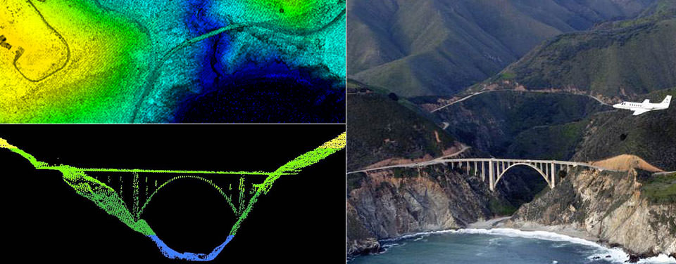
Aerial photogrammetry:
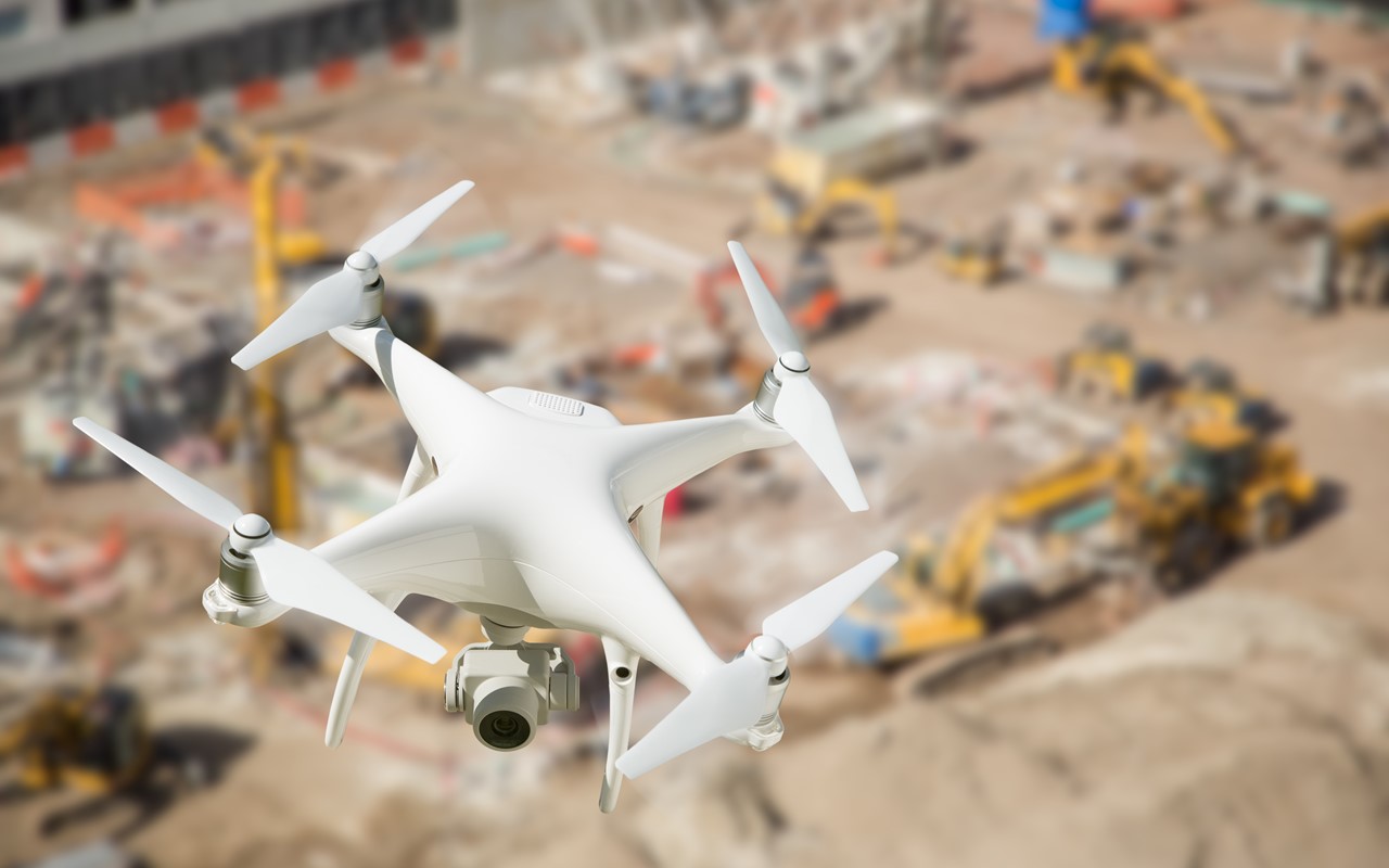
The process of utilizing aircrafts to produce aerial photography that can be turned into a 3D model or mapped digitally. Now, it is possible to do the same work with a drone. Drones have made it easier to safely capture hard-to-access or inaccessible areas where traditional surveying could be dangerous or impractical.
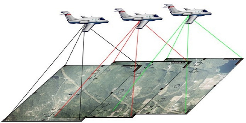
Drone mapping:
Drone mapping is the process of acquiring multiple aerial images and then stitching them together digitally with specialized software, creating a larger and more accurate composite image. The practice of drone mapping is called photogrammetry, and is used in fields such as topographic mapping, architecture, engineering, manufacturing, quality control, and more.
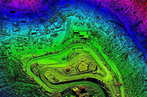
Digital Terrain Model (DTM)
A digital terrain model (DTM) can be described as a three – dimensional representation of a terrain surface consisting of X, Y, Z coordinates stored in digital form. It includes not only heights and elevations but other geographical elements and natural features such as rivers, ridge lines, etc. A DTM is effectively a DEM that has been augmented by elements such as breaklines and observationsother than the original data to correct for artifacts produced by using only the original data. With the increasing use of computers in engineering and the development of fast three-dimensional computer graphics the DTM is becoming a powerful tool for a great number of applications in the earth and the engineering sciences.
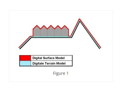
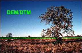
Digital Elevation Model (DEM)
Digital Elevation Models (DEMs) are a type of raster GIS layer. In a DEM, each cell of raster GIS layer has a value corresponding to its elevation (z-values at regularly spaced intervals). DEM data files contain the elevation of the terrain over a specified area, usually at a fixed grid interval over the “Bare Earth”. The intervals between each of the grid points will always be referenced to some geographical coordinate system (latitude and longitude or UTM (Universal Transverse Mercator) coordinate systems (Easting and Northing). For more detailed the information in DEM data file, it is necessary that grid points are closer together. The details of the peaks and valleys in the terrain will be better modeled with small grid spacing than when the grid intervals are very large.
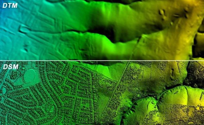
Digital Surface Model (DSM)
Digital Surface Model (DSM) represents the MSL elevations of the reflective surfaces of trees, buildings, and other features elevated above the “Bare Earth”.

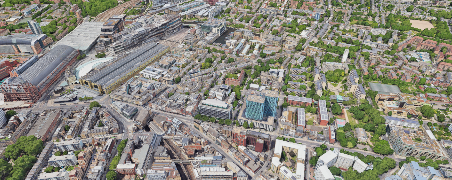
3D city Model:
A 3D city model is digital model of urban areas that represent terrain surfaces, sites, buildings, vegetation, infrastructure and landscape elements in three-dimensional scale as well as related objects (e.g., city furniture) belonging to urban areas. Their components are described and represented by corresponding two- and three-dimensional spatial data and geo-referenced data. 3D city models support presentation, exploration, analysis, and management tasks in a large number of different application domains. In particular, 3D city models allow "for visually integrating heterogeneous geo information within a single framework and, therefore, create and manage complex urban information spaces. These models are typically created using various technologies, including photogrammetry, LiDAR (Light Detection and Ranging), satellite imagery, GIS (Geographic Information Systems), and computer graphics software.
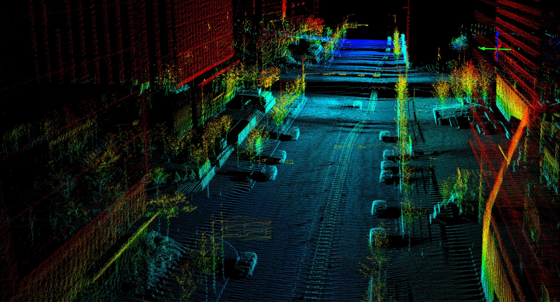
LiDAR:
LiDAR is an acronym for Light Detection and Ranging. In LiDAR, laser light is sent from a source (transmitter) and reflected from objects in the scene. The reflected light is detected by the system receiver and the time of flight (TOF) is used to develop a distance map of the objects in the scene.
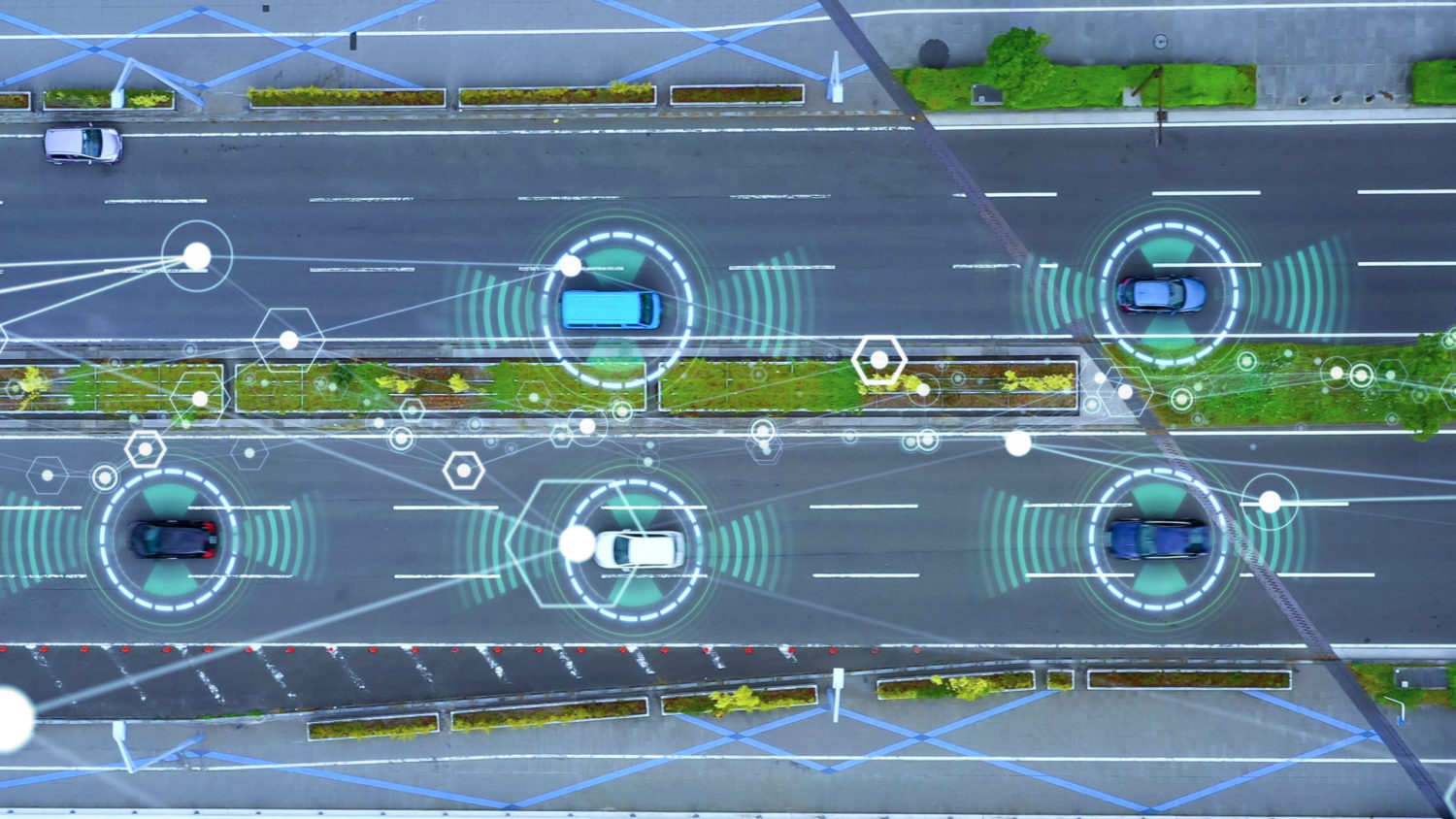 LiDAR is an optical technology often cited as a key method for distance sensing for autonomous vehicles. Many manufacturers are working to develop cost-effective, compact LiDAR systems. Virtually all producers pursuing autonomous driving consider LiDAR a key enabling technology, and some LiDAR systems are already available for Advanced Driver Assistance Systems (ADAS).